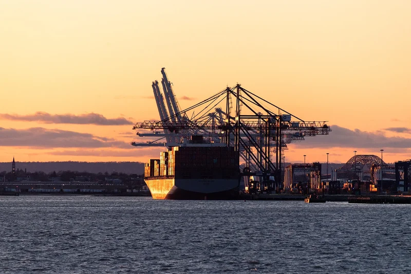
Typhoon Dolphin hits Okinawa as China shuts ports ahead of landfall
Japan · TRADE
Okinawa absorbs the first blow
Typhoon Dolphin slammed into Japan's southern island of Okinawa with fierce winds and heavy rain, injuring six people in Japan and cutting electricity to more than 50,000 buildings, around 39,000 of them in Kagoshima and just over 12,000 in Okinawa. Evacuation orders covered about 260,000 residents across the two prefectures.
Naha Airport, Okinawa's main air gateway, closed entirely, and all domestic and international flights were cancelled, the Associated Press confirmed. Shelters were opened across the island as the storm moved through, leaving a trail of power outages and transport paralysis.
Japan’s Meteorological Agency measured maximum sustained winds of 162 kilometres per hour, with gusts reaching 216. A widely quoted 195 kilometres per hour figure is a forecast value rather than an observation, and China’s National Meteorological Center expects 137 to 162 kilometres per hour at landfall. Okinawa also hosts significant United States military facilities, which The Maritime Executive said were preparing to weather the storm in place.
China races to shut its busiest port corridor
As Typhoon Dolphin churned westwards, Chinese authorities moved swiftly to close ports and suspend transport across Zhejiang province. Operations were halted across the Ningbo-Zhoushan complex, the world’s busiest port by total tonnage, vessels were cleared from Shanghai’s Yangshan deep-water terminal, and the Yangtze estuary and delta were closed to shipping.
The province also suspended 162 passenger ferry routes and ordered schools and water activities to stop. Ningbo Lishe International Airport scheduled a full suspension of operations on Sunday, deepening the transport freeze across one of China's most industrialised coastal strips.
The corridor is described by maritime analysts as the busiest region for containerised freight traffic in the world. Even a short typhoon-related stoppage can ripple through shipping schedules, fuel bunkering, export manufacturing, and downstream logistics across Asia and beyond.
Landfall timing and the flood threat inland
A United States Embassy weather alert placed the expected landfall window between 9 and 10 August 2026, with the most likely impact zone stretching from Zhoushan in Zhejiang to Fuding in Fujian. Multiple sources confirmed the late-Sunday-to-early-Monday timeframe, giving emergency planners a narrow window to act.
Chinese forecasters expect rain and wind to affect eastern China through 12 August, with river rises across the Yangtze and Taihu basins. That inland flood risk means the economic disruption may extend well beyond the immediate coastal port zone.
About 500 flights were cancelled in Japan on Friday, with a further 78 in Taiwan, as airlines scrambled to reposition aircraft and passengers faced extended delays. The combination of port closures, flight cancellations, and ferry suspensions has effectively sealed off a critical segment of China's eastern seaboard.
Why a typhoon becomes a trade story
The Shanghai–Ningbo–Zhoushan corridor is not just another stretch of coastline. It anchors China's export machine, port-led industrial production, and fuel imports, making it a weathervane for global supply-chain health.
Temporary closures at Ningbo-Zhoushan and Yangshan show how China's trade flow depends on dense coastal infrastructure. A few hours of storm preparation can alter shipping windows, bunker supply, container throughput, and the output of port-adjacent factories that feed global retailers.
The disruption arrives at a moment when supply-chain resilience is already under scrutiny, and climate-driven shocks to Asia's logistics backbone are pushing exporters everywhere to build slack into their shipping plans.
What it means for Brazilian and Latin American exporters
This is where a Japanese weather story becomes a Latin American trade story. Ningbo-Zhoushan and Shanghai are the main discharge points for Brazilian iron ore and soybeans, and the timing is awkward. More than 66 million tonnes of bulk commodities are scheduled for discharge at Chinese ports over the next fortnight, iron ore the largest single share at 20.4 million tonnes this week and 23.9 million next.
Congestion from the previous typhoon had not cleared when Dolphin arrived, so the queue starts from a worse position than usual, and Brazil is named among the exposed suppliers. For exporters and freight buyers the number to watch is not the wind speed but the berth backlog once the ports reopen, because that is what feeds through to freight rates and to what Brazilian cargoes fetch on arrival.
Geopolitics swirls beneath the storm
Okinawa is not merely a Japanese island chain. It hosts major United States military facilities, and The Maritime Executive noted those installations were preparing to ride out the typhoon, underscoring the storm's relevance to the United States–Japan security architecture in the western Pacific.
The expected impact zone between Zhejiang and Fujian sits inside the broader East China Sea arena, where commercial shipping, military posture, and Taiwan contingencies overlap. The United States Embassy alert covering that strip reflects the strategic sensitivity of any disruption there.
The storm is unfolding against a deteriorated China–Japan relationship over Taiwan and security issues, with reports of Chinese trade and export pressure on Japan in 2025 and 2026. That does not alter the typhoon's meteorology, but it amplifies the political weight of every port closure and transport halt in the region.
What to watch as Typhoon Dolphin makes landfall
The immediate focus is on the 9 to 10 August landfall window and whether the storm tracks further south towards Fujian or holds its course over Zhejiang. Shipping lines, insurers, and manufacturers will be watching port reopening timelines closely.
The inland flood risk flagged by Xinhua means river levels across the Yangtze and Pearl basins will be monitored for weeks. Any significant flooding could delay the restart of factory output and logistics even after the ports themselves reopen.
For global trade, the episode is a reminder that the world's most critical shipping corridor can be brought to a standstill by a single weather system. The speed of recovery will determine whether Typhoon Dolphin becomes a footnote or a measurable drag on August trade flows.
Frequently asked questions
When will Typhoon Dolphin make landfall in China?
A United States Embassy weather alert said landfall is expected between 9 and 10 August 2026, most likely between Zhoushan in Zhejiang and Fuding in Fujian.
Which Chinese ports have been closed?
Operations were halted across the Ningbo-Zhoushan complex, vessels were cleared from Shanghai’s Yangshan terminal and the Yangtze estuary was closed to shipping.
How strong is Typhoon Dolphin?
Japan’s Meteorological Agency measured maximum sustained winds of 162 kilometres per hour with gusts to 216; a widely quoted 195 kilometres per hour is a forecast value, not an observation.
Sources
This article was produced by The Rio Times’ automated newsroom system. How we use AI · Report an error
LatAm Markets: Live Signals → — real-time movers, turnover leaders and FX across Latin America.