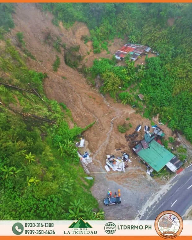
BAGUIO CITY, Philippines — A bird’s-eye view taken on Saturday, Aug. 8, shows the extent of the landslide that struck Barangay Shilan in La Trinidad, Benguet, two days earlier, killing two people and leaving another injured. The aerial image, released by the La Trinidad Municipal Disaster Risk Reduction and Management Office (MDRRMO), shows a wide stretch of mud and debris that swept down the hillside toward structures near the road. The landslide occurred at around 8 a.m. on Thursday, Aug. 6, according to the La Trinidad Municipal Police Station. READ: Nearly 9,000 barangays nationwide at risk for floods, landslides One victim […]...Keep on reading: Aerial view shows extent of deadly Benguet landslide
Aerial view shows extent of deadly Benguet landslide