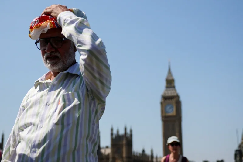
Temperatures are expected to drop next week as the UK’s fifth heatwave of the year comes to an end.
The country is on track to be the hottest summer on record as temperatures hit 38.1C on Thursday according to provisional Met Office data that shows the UK’s mean temperature for meteorological summer so far is currently at 16.48C – that is 1.88C above the 1991 to 2020 average temperature.
England has so far recorded a mean summer temperature of 18.19C so far, 2.46C above average. The remainder of August would need to be 1.41C below the summer average for England to equal its current warmest summer on record, also set in 2025.
Persistent dry and hot weather is taking its toll on England and Wales with about 70 per cent in drought. Following a record dry July and very low levels of rain at the start of August, 27 million people are now under water-use restrictions.
As barbecues have been banned and fire brigades tackle blazes across the country, many are wondering when will this fifth heatwave end - and will it be the last of the summer?
Cooler temperatures coming in
Temperatures are lowering after the record-breaking heat seen on Thursday. This weekend is expected to bring slightly lower, but nonetheless balmy, temperatures of 27C across the south east of England, prolonging heatwave conditions.
Heatwave conditions are met when a location records a period of at least three consecutive days with daily maximum temperatures meeting or exceeding the temperature threshold set for that area. This range sits between 25C and 28C.
London will already see cooler temperatures on Sunday with the thermometer peaking at 26C, outside the heatwave threshold. The midlands and the north of England will also drop out of the heatwave threshold with temperatures of 24C and lower predicted on the Met Office map.
While Monday and Tuesday will see temperatures rise again, from Wednesday onwards only peaks of 25C are predicted next week as the thermometer in Manchester dips below 20C.
As well as cooling temperatures, the Met Office has suggested some rain could come in to the south next week.
Deputy chief forecaster, Steven Keates, said: “Many people are desperate for some rain to alleviate the impacts of the prolonged dry spell. There is a chance of some thunderstorms developing in central and southeastern parts of England later on Friday into Saturday, however these are very uncertain.
“A front moving south eastwards across the UK on Monday and Tuesday could bring northern areas some rain but amounts of rain in the south will be small at most and the majority will fall over Northern Ireland and Scotland. The next meaningful rain forecast for these very dry areas could be towards the end of next week as an area of low pressure influences our weather from the southwest. The detail on this will become clearer over the coming days, so stay up to date with the forecast.”
What does the long range forecast say?
The Met Office long range forecast shows high pressure may start to weaken next week bringing the potential for some showers or longer spells of rain. But temperatures are still expected to be slightly above average.
However, towards the end of the month, high pressure is predicted to return, which is likely to bring back longer periods of dry weather and warm temperatures and maybe even another heatwave.
"Looking ahead, forecasts indicate temperatures will remain well above average through much of the coming week, with another spell of heatwave conditions expected to develop in some areas,” Met Office senior scientist Mike Kendon said.
“While individual hot spells do not determine seasonal records on their own, sustained periods of warmth throughout the summer have contributed to the exceptionally high average temperatures we've seen so far,” he added.
That means the UK could see another heatwave, which would bring the total for the year to six.
What records have been broken this summer?
The Met Office said on Thursday afternoon temperatures provisionally reached 38.1C at Kew Gardens in London, the hottest day of the year so far and the second time this year the country has seen temperatures hit 38C.
A further 10 weather stations were at or above 36C, the provisional figures from the Met Office showed.
It makes 2026 the first year on record to see three separate days where temperatures reached the 37C threshold, as well as the first year with four days at 36C or above.
Before 2026, the UK had recorded 37C or higher on only six occasions.
It also extends 2026’s record-breaking run of days above 35C.
For four months in a row temperatures hit 35C in the UK on at least one day in May, June, July and now August.
July was also the driest month since records began in 1836 in both England and Wales, southern England alone had its driest calendar month ever on record.
By 15 July this year the UK had already recorded more days above 30C than in the whole of 1976, which was known for its long-lasting heatwave.