This phenomenon became known as the coastline paradox, and it applies to virtually all borders, boundaries and coastlines with especially jagged, twisting lines – like England's.
"Let me show you what this paradox looks like," said Danny Hyam, a senior geospatial consultant for the Ordnance Survey, Great Britain's national mapping agency.
"This is Britain's coastline at a scale of 1:1,000,000," he said, pulling up a broad, boxy border around the territory on his computer screen. "At that scale, it gives you a [coastline] measurement of 16,652km (10,347 miles). If I go down to 1:250,000, you start to see a bit more detail along the edges, islands appear that didn't before and that coastline is now 22,400km (13,919 miles). If we go to 1:50,000, jetties and more defined inlets appear, and our coast becomes 28,509km (17,715 miles) long. Then if I go to 1:2,500, the coastline becomes even more complicated, and it has now more than doubled in length."
Hyam added, "If I were to go down to 1:1, you'd be going around every barnacle, and suddenly our coastline would become longer, and longer and longer." As he explained, that is the paradox: the closer you look, the longer the coastline becomes.
Getty Images
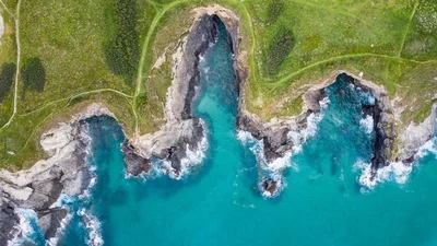
If you were to measure every barnacle, grain of sand or atom along England's coastline, the measurement would approach infinity (Credit: Getty Images)