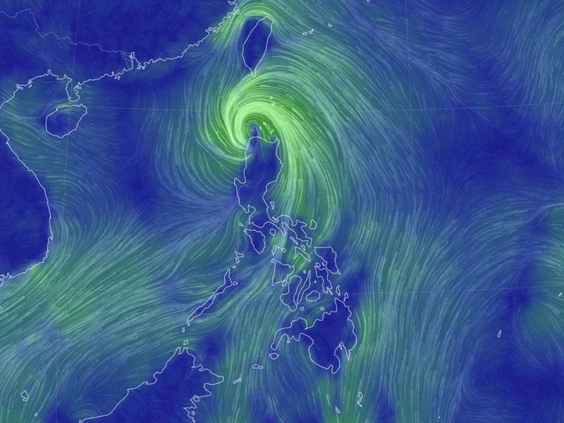
'Kiyapo' makes landfall in Cagayan; Signal No. 2 still up over parts of Northern Luzon
MANILA, Philippines — Tropical Storm Kiyapo (international name: Noul) made landfall over Camiguin Island in Calayan, Cagayan on Friday afternoon as it continued moving across Extreme Northern Luzon.
In its 5 p.m. bulletin Friday, July 24, PAGASA said the center of the tropical storm was estimated over the coastal waters of Calayan Island, Cagayan after making landfall.
Kiyapo packs maximum sustained winds of 85 kilometers per hour near the center, gustiness of up to 115 kph. It is moving west-northwestward at 30 kph.
Wind signals. Tropical Cyclone Wind Signal No. 2 remains hoisted over:
- Batanes;
- northern portion of Cagayan, including the Babuyan Islands;
- northern portion of Apayao
- northern portion of Ilocos Norte
Under Signal No. 2, gale-force winds of 62 to 88 kph may be experienced within 24 hours, posing a minor to moderate threat to life and property.
Meanwhile, Signal No. 1 remains over:
- rest of mainland Cagayan
- Isabela
- Quirino
- Nueva Vizcaya
- rest of Apayao
- Abra
- Kalinga
- Mountain Province
- Ifugao
- Benguet
- rest of Ilocos Norte
- Ilocos Sur
- La Union
- northern and central portions of Aurora.
Areas under Signal No. 1 may experience winds of 39 to 61 kph within 36 hours, posing minimal to minor threats to life and property.
PAGASA said the hoisting of Signal No. 3 is not ruled out should Kiyapo intensify into a severe tropical storm while traversing the Batanes-Babuyan Islands area.
Strong winds. The southwest monsoon and Kiyapo's circulation will continue to bring strong to gale-force gusts over most of the country on Friday, particularly in coastal and upland areas.
On Saturday, gusty conditions are expected over most of Luzon, Western Visayas, the Negros Island Region, Cebu, Northern Samar, Zamboanga del Norte, Sultan Kudarat and Davao Oriental. By Sunday, strong to gale-force gusts may affect Batanes, Cagayan, the Ilocos Region, Zambales, Bataan, Quezon and MIMAROPA.
Sea conditions. A gale warning also remains in effect over the northern seaboard of Northern Luzon.
PAGASA warned of very rough seas of up to 5.5 meters over the seaboards of Batanes and the Babuyan Islands and up to 4.5 meters over the northern coasts of mainland Cagayan and Ilocos Norte. Sea travel remains risky for all types of vessels, with mariners advised to stay in port or seek shelter.
Rough to moderate seas are also expected over several seaboards in Luzon, Visayas and Mindanao. Operators of motor bancas and similarly sized vessels are advised to take precautionary measures and avoid unnecessary sea travel.
Track, intensity. PAGASA said Kiyapo will continue moving west-northwestward over the Luzon Strait and the West Philippine Sea before turning northwestward to northward.
The tropical storm is expected to exit the Philippine Area of Responsibility tonight or early Saturday.
Kiyapo may intensify into a severe tropical storm while or after passing the Babuyan Islands.
Over the West Philippine Sea, it may undergo rapid intensification and reach typhoon strength before making landfall over southern mainland China.
- Latest
- Trending