Sign in. It’s quick, free and it’s up to you.
An account is an optional way to support the work we do. Find out more.
MORE THAN HALF of land affected by Irish wildfires over the past decade overlapped Natura 2000 protected sites, The Journal Investigates can reveal.
The analysis sets Ireland apart from many of the European countries most commonly associated with wildfire devastation.
The findings come as firefighters in Co Tipperary said they had made significant progress in containing a wildfire on Slievenamon. It had been burning since last Monday and had intensified midweek, when some locals began making preparations ahead of possibly having to evacuate their homes.
Elsewhere, firefighters had battled a series of major blazes during the recent spell of hot weather, including fires on the Wicklow-Dublin border, near Crosshaven in Cork and in Killarney National Park.
Campaigners say better prevention and enforcement is needed to tackle blazes, which are almost always caused by human activity, including agricultural burning that gets out of control, deliberate fire-setting, campfires and disposable barbecues that are not properly extinguished.
Yet while the ‘mega fires’ that regularly make headlines in countries such as Greece, Spain and Portugal are largely concentrated in forests, analysis suggests Ireland’s fires are disproportionately affecting landscapes protected under European environmental legislation – including heath, scrub, uplands and peat-associated vegetation.
Data gathered as part of a Europe-wide investigation found that of the 31,491 hectares of land damaged in gorse and wild fires here between 2015 and 2025, a total of 16,910 hectares overlapped Natura 2000 sites.
EU-wide annual figures show that, between April and October from 2015 to 2025, wildfires overlapped nearly 1.3 million hectares of land within Natura 2000 protected areas.
Across the 26 countries analysed, an average of 30.1% of the land burned by wildfires overlapped with Natura 2000 sites. In Ireland, the equivalent figure was substantially higher, at almost 54%.
Natura 2000 sites are protected under the EU Birds and Habitats Directives and are designated to safeguard some of Europe’s most valuable and threatened species and habitats. Ireland has more than 600 of these sites.
** ** Investigations like this don’t happen without your support… Impactful investigative reporting is powered by people like you.
The analysis was carried out as part of a cross-border investigation coordinated by the Mediterranean Institute for Investigative Reporting (MIIR), with the collaboration of the EDJNET network – which includes The Journal Investigates.
Using data from the European Forest Fire Information System (EFFIS) – the European Commission’s harmonised wildfire monitoring platform – journalists found that a total of 31,491 hectares of land that went on fire in Ireland between 2015 and 2025 could be classed as a wildfire.
The figures were collected during the fire season months of April to October. Overall, our investigation found that wildfires burned almost 4.5 million hectares (4,534,317) across the 26 European countries analysed, an area the size of Estonia.
Our analysis identified 23,391 unique fires across those countries between 2015 and 2025 during the fire season.
A total of 300 individual fires were recorded in Ireland between 2015 and 2025. The annual number fluctuated considerably, from a low of six in 2016 to a high of 79 in 2025.
Small and medium-sized fires were the most common, with 96 fires recorded in each category. Small fires affected between five and 30 hectares, while medium-sized fires burned between 30 and 100 hectares.
A further 59 fires were classified as large, affecting between 100 and 1,000 hectares, while 46 were very small, affecting fewer than five hectares.
Three fires were classified as very large, burning between 1,000 and 5,000 hectares. No extreme or ‘mega’ fires – those affecting more than 5,000 hectares – were recorded during the period.
Journalists used Python-based spatial analysis to examine individual wildfire polygons – mapped boundaries of the area affected by a fire – from the EFFIS Rapid Damage Assessment system. This found wildfire activity in Ireland is primarily concentrated in areas of natural vegetation and protected landscapes.
In our analysis, 29,538 hectares were classified as natural vegetation. Forest land accounted for 1,156.49 hectares, while agricultural land represented 582 hectares.
The figures reveal a wildfire profile that differs significantly from that seen across much of southern Europe.
Where European wildfire discussions frequently centre on forests, drought and Mediterranean conditions, Ireland’s fires are overwhelmingly concentrated in bogs, heather covered hillsides, scrub and other rough upland ground.
The analysis also found that wildfire activity was concentrated primarily in western and south-western regions.
The west was the worst-affected area, accounting for 12,168 hectares, or almost 39% of the national total. In the south-west almost 8,000 hectares were affected.
Together, these two areas accounted for almost two-thirds of all land affected by wildfires during the period. Dublin recorded the smallest area affected, at 310 hectares.
The figures suggest Ireland’s wildfire risk does not fit neatly into traditional European assumptions around wildfire management and prevention.
The statistics emerge against a backdrop of several significant fires affecting environmentally sensitive landscapes in recent years.
In May, a large fire affected 66 hectares within Wicklow Mountains National Park after flames broke out on an open hillside near the Glenasmole Valley.
The incident triggered a major response involving Dublin Fire Brigade, the National Parks and Wildlife Service (NPWS) personnel and Coillte staff.
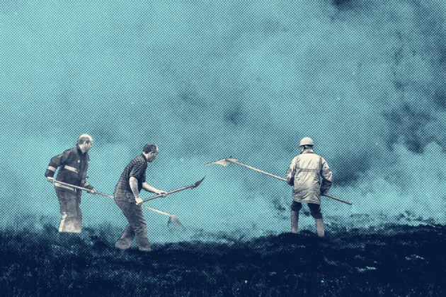
The large-scale operation included helicopter water drops to bring the fire under control, with firebreaks dug to protect nearby homes.
That followed a number of other significant gorse incidents reported in recent years, including fires affecting parts of Killarney National Park and upland habitats elsewhere across the west and south-west of the country.
While these types of fire events can appear isolated, our decade-long analysis suggests they form part of a broader pattern in which large fires repeatedly overlap protected landscapes.
The analysis does not indicate that Natura sites were entirely burned, nor does it measure the severity of ecological impacts within those areas.
Rather, it shows that wildfire perimeters repeatedly overlapped parts of landscapes protected under EU environmental legislation.
Ecologist Pádraic Fogarty said many upland fires begin with attempts to burn back heather, gorse and scrub to create fresh grazing for livestock.
He also said the figures reinforce concerns about recurring fires affecting landscapes designated for conservation.
“A lot of these fires are happening in Natura 2000 sites that have conservation objectives, and you’ve got birds and all kinds of other things,” he said.
Much of the controlled burning that has happened in Ireland has traditionally been used to clear dense, ageing heather and scrub from upland grazing land, with the intention to keep the land open and encourage fresh, lower-growing vegetation that sheep can eat.
“The peatland soil gets damaged by fires, there’s a lot of evidence to show how harmful it is, even if it’s done in a controlled way, but that message is not being sent to farmers in upland areas.
“There’s still a view within a lot of the upland farming communities that what they would call controlled burning is an important agricultural practice, and is part of the solution,” he added.
Fogarty said attitudes had improved over the last decade but warned that recurring fires remain a significant issue.
Fogarty said not all serious wildfires in Ireland are related to agricultural practices. He points to fires which have taken place on the outskirts of Dublin where no farming takes place.
“These are called urban interface fires, where people just maliciously go out – or it could be not malicious people having barbecues or throwing cigarette ends.
“So it’s hard to say how much of us it is agricultural and how much of it is that kind of urban interface pyromania. We don’t have the figures.”
A spokesperson for Coillte told us: “In our experience forest fires in Ireland do not occur naturally and are almost always the result of human activity.
“This includes campfires and disposable barbecues that are lit and not extinguished properly in the outdoors and also burning of vegetation on land that gets out of control.”
DAFM confirmed to The Journal Investigates that currently, no centralised national wildfire database in Ireland exists, and that wildfire information is not systematically shared or collated between agencies.
Instead, the department relies heavily on Copernicus and EFFIS satellite systems for monitoring and analysis.
The department also confirmed it does not hold more granular wildfire statistics, it does not centrally collate wildfire costs and it does not maintain a standalone figure for expenditure on wildfire prevention and cost.
A spokesperson said: “The Department uses Copernicus and EFFIS data for fire monitoring, as these are considered accurate and appropriate to the scale and nature of fire regimes across all land types in Ireland.
“The Department does not hold more granular statistics on fire activity; the resolution of EFFIS data is considered sufficient for most fire protection, monitoring and analysis purposes.”
The absence of a central database means responsibility for wildfire information remains spread across multiple organisations.
DAFM oversees policy and reporting, the NPWS is responsible for biodiversity protection and Natura 2000 sites while Coillte manages State forestry lands and maintains its own operational records.
Yet no single body can provide a complete national picture of wildfire impacts and costs when asked by The Journal Investigates.
Across all agencies contacted, there was broad agreement that human activity remains the primary cause of fires in Ireland.
Coillte said more than 300 fires have been recorded on Coillte-managed lands since 2021, damaging more than 2,500 hectares of forestry and associated lands.
The greatest occurrence of these fires has been in the north-west, south-east Leinster and south-west.
Coillte said that “greater awareness and responsible behaviour” would prevent many of these incidents.
The NPWS expressed a similar view, with a spokesperson telling The Journal Investigates that “the majority” of fires occurring on protected sites result from human activity, including illegal burning and recreational activities.
Because of this, the agency generally refers to such incidents as “illegal” or “uncontrolled” fires rather than wildfires.
-
This article is published in collaboration with the European Data Journalism Network in the context of ChatEurope. *Organisation and coordination by MIIR, with the collaboration of the EDJNET network. *
Konstantina Maltepioti/MIIR: Data collection and data analysis.
Szabó Krisztián/Atlatszo: Production of scrolly-telling for main story.
Janine Louloudi & Kostas Zafeiropoulos/MIIR: Research reporting for main article.
Reporter: Patricia Devlin • Editors: Noel Baker, Sinead O’Carrroll & Christine Boland • Social Media: Cliodhna Travers • Main Image Design: Lorcan O’Reilly
To embed this post, copy the code below on your site