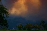
The sky above a wildfire can change with startling speed. A column of smoke begins to climb, swelling into something that looks less like a plume and more like an approaching storm. Daylight fades. Winds shift. Then lightning flashes inside a cloud born directly from the flames below.
Known as pyrocumulonimbus, or pyroCb, this rare phenomenon is sometimes described as a “fire cloud.” With France and Spain currently dealing with historic wildfires, these towering clouds are creating abundant challenges for firefighters. As blazes become intense enough to produce their own weather, they create a feedback loop in which lightning and extreme winds start new fires, repeating the cycle.
What Are Pyrocumulonimbus Fire Clouds?
According to the Australian Government Bureau of Meteorology, a fire cloud begins when extreme heat pushes smoke and hot air rapidly upward. As the plume rises into areas of lower atmospheric pressure, it expands and cools. Water vapor eventually condenses, forming a pyrocumulus cloud above the fire.
That condensation releases heat, making the cloud even more buoyant. Air accelerates upward, additional moisture condenses, and the cloud can develop into a massive thunderstorm.
The coldest regions of the cloud contain ice particles that collide and accumulate electrical charges. The result is lightning, just as in a conventional thunderstorm — except this storm is being powered by a wildfire.
The National Environmental Satellite, Data, and Information Service notes that pyroCb clouds can occasionally produce rain that helps suppress flames. But more often they introduce new dangers into an already volatile emergency.
Read More: Melting Ice Didn't Trigger Yellowstone Eruptions — but It May Have Sparked Hydrothermal Explosions
Why Fire Clouds Make Wildfires More Dangerous
Dangerous lightning isn’t the only concern when it comes to fire clouds.
The World Climate Research Programme warns that the towering updraft inside a fire cloud pulls surrounding air toward the blaze, generating strong winds from multiple directions. These winds can feed the fire with oxygen, increase its intensity and suddenly redirect nearby flames.
Powerful updrafts can also lift burning bark, branches, and other embers high into the atmosphere. Winds may carry that material far beyond the existing fire perimeter, where it can fall and ignite new blazes. Lightning from the cloud can start even more fires.
According to a study in Communications Earth & Environment, fire clouds have also produced hail, violent downdrafts, and tornado-like vortices. On the ground, dense smoke and near-nighttime darkness may leave firefighters and residents disoriented just as conditions begin changing rapidly. That loss of visibility and situational awareness is especially dangerous in communities along the expanding boundary between wilderness and developed land.
Studying the Hidden History of Fire Clouds
Scientists have only recently begun treating pyroCb storms as a distinct area of research. The term pyrocumulonimbus was not widely used in science before 2004, and the phenomenon gained broader attention during Australia’s devastating 2019–2020 Black Summer. Those fires generated an extraordinary outbreak of 18 fire cloud events.
The Communications Earth & Environment study suggests similar storms occurred long before researchers had a name for them. In 1950, smoke from the enormous Chinchaga fire near the British Columbia-Alberta border darkened skies across parts of Canada and the eastern U.S. before reaching Europe. Researchers now suspect a fire cloud may have helped inject that smoke high into the atmosphere, although the connection may never be confirmed.
Recent wildfires in Australia, Canada, and the U.S. have given NASA, the National Oceanic and Atmospheric Administration, and other research groups more opportunities to study the phenomenon. Yet scientists still need better satellite measurements and dedicated field experiments to identify when an ordinary smoke plume is about to become a fire cloud.
Accurate forecasting could give emergency crews valuable warning before winds shift, embers travel, or lightning begins. As extreme fires reach more regions, understanding what happens above the flames may become just as important as tracking the fire on the ground.
Read More: Brightening Clouds With Microscopic Sea Salt Particles Could Weaken Super El Niños in the Future
Article Sources
Our writers at Discovermagazine.com use peer-reviewed studies and high-quality sources for our articles, and our editors review for scientific accuracy and editorial standards. Review the sources used below for this article:
- This article references information from the National Environmental Satellite, Data, and Information Service: What Is a Firestorm?
- This article references information from the World Climate Research Programme: The link between pyrocumulonimbus and climate change
- This article references information from the Australian Government Bureau of Meteorology: When bushfires make their own weather
- This article references information from a study published in Communications Earth & Environment:Understanding the critical elements of the pyrocumulonimbus storm sparked by high-intensity wildland fire