When a wall of water suddenly crashes from the sky and sweeps away homes and roads within minutes, one of the first words officials and the media in India reach for is ‘cloudburst’. However, the term is often misused in a way that can distract from poor planning and crumbling infrastructure.
What counts as a cloudburst?
According to the India Meteorological Department (IMD), a cloudburst occurs when a small area, around 20-30 sq. km, receives 10 cm or more of rain in an hour.
To put this in perspective, Indore receives 1,062 mm of rain every year on average. A cloudburst could dump nearly 10% of this in 60 minutes.
Heavy rains are a common feature of the southwest monsoon, but a cloudburst is still an extraordinary amount of rainfall and much rarer.
Because the water falls so quickly over a relatively small area, the ground cannot absorb all of it, leading to rapid and voluminous flooding.
Some scientists have also advocated for a category called ‘mini-cloudburst’, for 5 cm of rain in an hour over the same area, as, depending on the local topography, this can be devastating as well.
How common are cloudbursts in India?
Although cloudbursts are relatively rare, global warming, in particular as the atmosphere warms and can hold more moisture, is making them more frequent.
In response to a question, former Union Earth Sciences Minister Harsh Vardhan told Parliament in 2019 that between 1970 and 2016, the IMD had recorded only around 30 such incidents. However, many experts believe this number is an underestimate.
Counting them is not straightforward because most cloudbursts occur in remote, high-altitude regions such as the Himalaya and the Western Ghats, where rain gauges and weather stations are sparse.
In fact, if a cloudburst occurs a few kilometres away from a monitoring station, it may not be officially recorded as a cloudburst even if it causes large-scale destruction downstream.
Uttarakhand, Himachal Pradesh, and Jammu and Kashmir have, of late, reported a surge in events that locals have described as cloudbursts, especially in July and August.
How does a cloudburst form?
Contrary to the name, a cloudburst is not the literal bursting of a cloud, like a water balloon that has been popped.
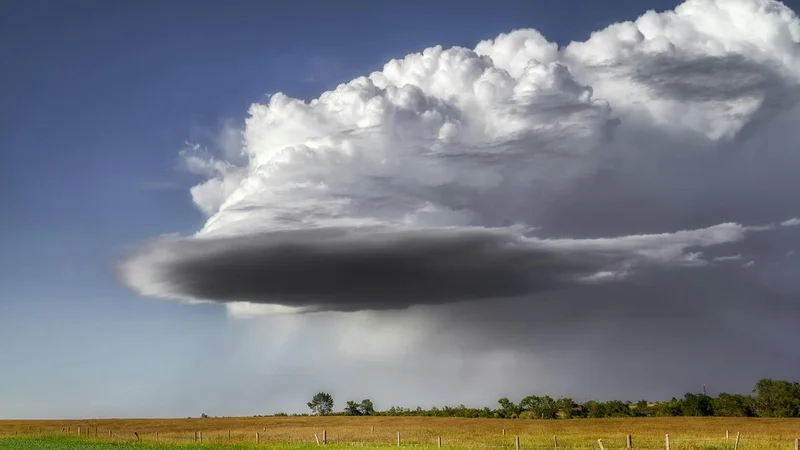
A cloudburst typically begins with convection, when warm, moist air rises rapidly into the atmosphere. In mountainous areas, this is called orographic lifting, where monsoon winds are forced upwards by steep slopes.
As the air rises, it cools and condenses into towering cumulonimbus clouds, which can be up to 15 km tall.
Water droplets begin to form inside these clouds and, as they get heavier, they would normally fall as rain.
However, if the currents of warm air moving upwards are very strong, they can keep the raindrops suspended in the air for longer.
Eventually, the weight of the water droplets becomes too great for gravity and the updrafts to hold, or the updrafts weaken, sending the water plummeting down like an ocean descending on the ground.
Can the label obscure accountability?
The science of cloudbursts is clear, whereas the political use of the word ‘cloudburst’ is murky.
By calling a heavy downpour a ‘cloudburst’, authorities can turn it into a singular and unforeseeable act of nature, obscuring the role of human negligence.
That is, if the cause of a tragedy is said to be a ‘cloudburst’, the blame can be written off, which is harder to do when the real cause is “heavy rain combined with poor drainage”.
Following the 2022 floods in the Godavari basin in Telangana, then Chief Minister K. Chandrasekhar Rao said they might be the result of a “foreign conspiracy” involving cloudbursts.
However, independent experts said he was trying to draw attention away from the failure of the multibillion-dollar Kaleshwaram irrigation project, whose pump houses themselves were submerged.
In 2025, during the Dharali floods in Uttarakhand, initial reports blamed a cloudburst. However, meteorological data later showed that the actual rate of rainfall was much lower than the threshold for a cloudburst.
The underlying causes were illegal construction on riverbeds, deforestation that had left soil vulnerable to erosion, and the absence of drainage infrastructure along new “all weather” roads.
Had the downpour indeed been a cloudburst, officials may have been able to avoid questions about why the State had allowed buildings to be constructed in high-risk zones and why early warning systems failed.
Last week, the IMD rejected reports that Assam and Nagaland had experienced cloudbursts over the preceding few days and that they were responsible for the Upper Assam floods.
Are cloudbursts hard to forecast?
Cloudbursts are very difficult to forecast. Meteorologists can usually say whether a region is at risk of heavy rain but cannot say precisely which patch of land will experience a cloudburst.
First, most weather models study the atmosphere in grids and estimate the average weather for each cell.
A cloudburst, on the other hand, occurs over an area smaller than the size of each grid cell. To detect one, scientists need very high-resolution models, which in turn require immense computing power that is not always readily available.
Because of the mechanism through which cloudbursts form, they also develop and occur quickly. Cyclones and monsoon systems, on the other hand, can be tracked for weeks or even months, giving scientists more data to work with.
Finally, mountains are challenging environments for weather monitoring, and cloudbursts have a greater propensity to occur there.
For instance, Doppler weather radars work by emitting and receiving radar beams, which mountains can block, creating blind spots over many areas where cloudbursts are also more common.
Because the terrain is so rugged, there are also fewer automatic weather stations. If there are no sensors on the ground to tell a computer what is happening at a given moment, it cannot reliably predict what could happen in the next hour.
That said, the IMD is currently working on ‘nowcasting’, a technology that issues short-term alerts every few hours.
Under the Indian government’s new ‘Mission Mausam’, India also plans to more than double its radar network, from the current 40 or so, and use artificial intelligence to better predict hyperlocal events.
That said, even with the best technology, a cloudburst is likely to remain more difficult to predict than a typical rainstorm.
Published - July 29, 2026 01:30 pm IST