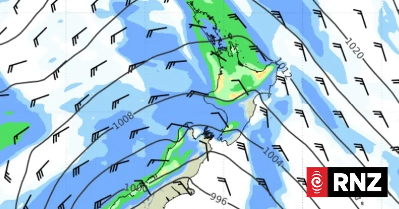
Strong wind and rain watches are in place for parts of the South Island and lower North Island as the weekend approaches.
MetService meteorologist John Law said "some wetter, windier weather" is moving back across Aotearoa on Thursday.
As it moved up, the western side of the South Island was as risk of thunderstorms.
By the end of Thursday, Law said the wet weather would make its way up to the North Island.
Along with the wet, there would be strong winds around areas including Canterbury high country and Wellington.
Friday would see "strong southerly winds for the south as well," Law said.
A heavy rain watch is in place for the Tararua Range from midnight Thursday until noon on Friday.
Periods of heavy rain were expected with the possibility of amounts approaching warning criteria.
MetService said there was a moderate change the watch would be upgraded to a warning.
Strong wind watches have been issued for Wellington, Canterbury high country, Christchurch, Banks Peninsula and the Canterbury Plains, coastal Otago and coastal Southland and southern Fiordland.
Wellington's watch was in place from 7pm Thursday until 2am Friday.
Canterbury high country's watch was already in place, and was due to end at 6pm.
The watch for Christchurch, Banks Peninsula and the Canterbury Plains is in place from 6pm to midnight Friday.
Coastal Otago's kicks in from noon Friday until 9pm, while the watch for coastal Southland and southern Fiordland is from 9am until 6pm Friday.
MetService said for all watches, winds could approach severe gales in exposed areas.
All watches had a moderate change of being upgraded to warnings.
"Those driving in gale-force winds are urged to take extra care, especially those operating high-sided vehicles, towing vehicles and motorcycles," MetService said.
The wet and windy weather follows chilling temperatures across the country.
In the South Island, the Mount Cook / Pukaki area registered a freezing -7C early on Monday morning.
Shortly after 7am, Twizel was still shivering at -7.5C, the MetService site recorded.
On Wednesday, MetService meteorologist Alwyn Bakker said a ridge of high pressure had gradually started to drift off to the east giving a bit of a lift in temperatures.
"Thursday is going to be a little bit warmer for most people, but then as we get into the weekend, it's going to start dipping down into those cooler temperatures again."