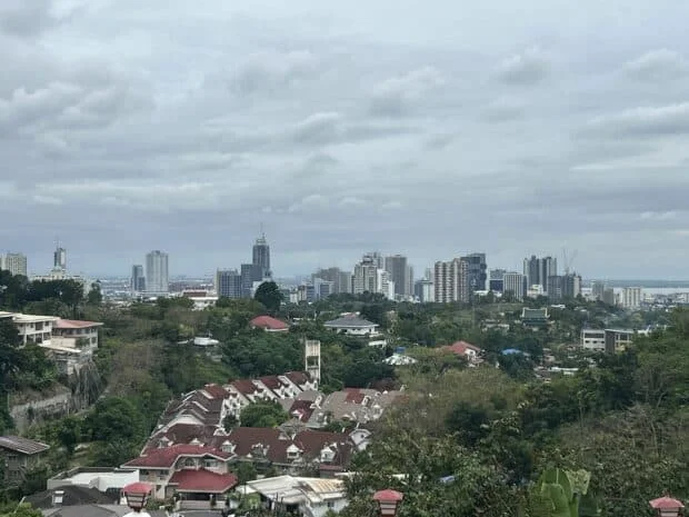
Cloudy, rainy weather to persist over Cebu in coming days — Pagasa
CEBU CITY, Philippines — Cloudy skies, rain showers, and thunderstorms will continue to affect Metro Cebu and the rest of the province over the next several days as localized thunderstorms and the trough of a low-pressure area keep weather conditions unsettled across the province, the state weather bureau said Friday.
The Philippine Atmospheric, Geophysical and Astronomical Services Administration (Pagasa) said Metro Cebu and the rest of the province can expect cloudy skies with rain showers and thunderstorms from Friday through at least Monday, with temperatures ranging from 25 to 32 degrees Celsius.
Engineer Al Quiblat, chief of Pagasa-Mactan, said residents should continue preparing for sudden afternoon and evening downpours, especially as July and August mark the peak of the country’s thunderstorm season.
“The rainy season runs from June to November. July and August are the peak months for thunderstorms, so afternoon and evening thunderstorms occur more frequently during this period than in other months,” Quiblat said.
He explained that even without a tropical cyclone, the Intertropical Convergence Zone (ITCZ), or a low-pressure area directly affecting Cebu, localized thunderstorms can rapidly develop and produce intense rainfall.
“Mga localized thunderstorm, bisan wala pa’y dako nga system, sama sa ITCZ, bagyo, low-pressure area, naa gyud nang high chance nga adunay thunderstorm occurrences nga maghatag og kalit-kalit nga pag-ulan. Usahay bundak kaayo ang ulan tungod sa development sa cumulonimbus clouds,” he said.
(Localized thunderstorms can occur even without a major weather system such as the ITCZ, a tropical cyclone, or a low-pressure area. There remains a high chance of thunderstorms developing within the day that can bring sudden rainfall. At times, rainfall becomes intense because of the rapid development of cumulonimbus clouds.)
LPA unlikely to become a storm
Pagasa continues to monitor a low-pressure area east of the country, but Quiblat said current forecasts indicate only a slim chance that it will develop into a tropical cyclone.
He said the weather disturbance could strengthen the southwest monsoon, or habagat, if it moves closer to the Philippines, but forecasters expect it to remain weak and eventually dissipate.
“Even if it enters the Philippine Area of Responsibility, it is unlikely to move close to land,” Quiblat said. “What affects us now is its trough or cloud extension.”
Because of this, Cebu may continue to experience light to moderate rains, with isolated thunderstorms capable of producing heavy downpours, particularly during the afternoon and evening.
Cebu weather forecast through Monday
Pagasa’s Visayas Regional Services Division forecast cloudy skies with rain showers and thunderstorms across Metro Cebu and the rest of Cebu Province from July 31 to August 4.
The weather bureau expects temperatures to range between 25 and 32 degrees Celsius, with light to moderate winds blowing from the northwest to southwest through the weekend before shifting to the southwest by Monday.
Coastal waters will remain slight to moderate, making sea conditions generally manageable for small vessels, although thunderstorms could still trigger rougher conditions.
Disclaimer: The comments uploaded on this site do not necessarily represent or reflect the views of management and owner of Cebudailynews. We reserve the right to exclude comments that we deem to be inconsistent with our editorial standards.