Signal No. 2 raised over 8 areas as 'Maymay' nears landfall
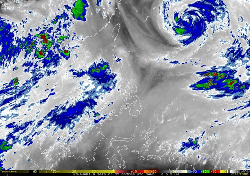
MANILA, Philippines — Tropical Storm Maymay (international name: Kujira) maintained its strength Wednesday afternoon as it moved north-northeastward over the sea west of Ilocos Sur, with parts of Northern Luzon remaining under Signal No. 2.
In its 5 p.m. bulletin on Wednesday, August 5, state weather bureau PAGASA said the center of Maymay was estimated at 145 kilometers west of Sinait, Ilocos Sur.
It was packing maximum sustained winds of 75 kilometers per hour, gustiness of up to 90 kph. Maymay was moving north-northeastward at 10 kph.
PAGASA said Maymay may make landfall over the Ilocos Norte–Ilocos Sur–La Union area by Wednesday night or early Thursday before crossing Northern and Central Luzon.
Wind signals
The following areas remain under Signal No. 2:
- Southern Ilocos Norte: Banna, Pinili, Badoc, Nueva Era, Sarrat, Paoay, Marcos, Currimao, San Nicolas, Dingras, Solsona and the City of Batac
- Ilocos Sur
- Northern and central La Union: Luna, Caba, Santol, Bauang, City of San Fernando, San Juan, Bagulin, Aringay, Bangar, San Gabriel, Burgos, Naguilian, Bacnotan, Sudipen and Balaoan
- Northwestern Pangasinan: Anda, Bolinao and Bani
- Abra
- Western Kalinga: Pasil, Tinglayan, Balbalan and Lubuagan
- Western Mountain Province: Besao, Tadian, Bauko, Sagada, Sabangan, Bontoc and Sadanga
- Northwestern Benguet: Mankayan, Kapangan, Kibungan, Sablan, Bakun, La Trinidad, Tublay, Atok and Buguias
Areas under Signal No. 2 may experience gale-force winds of 62 to 88 kph within 24 hours, posing a minor to moderate threat to life and property.
Meanwhile, the following areas are under Signal No. 1:
- Rest of Ilocos Norte
- Rest of La Union
- Rest of Pangasinan
- Apayao
- Rest of Kalinga
- Rest of Mountain Province
- Ifugao
- Rest of Benguet
- Mainland Cagayan
- Isabela
- Quirino
- Nueva Vizcaya
- Northern Zambales: Candelaria, Santa Cruz, Masinloc and Palauig
- Northern Tarlac: Mayantoc, San Clemente, Camiling, Santa Ignacia, Gerona, Paniqui, Moncada, San Manuel, Anao, Ramos, Pura and Victoria
- Northern Nueva Ecija: Carranglan, Lupao, Cuyapo, Talugtug, Nampicuan, Guimba, Science City of Muñoz, San Jose City, Pantabangan, Bongabon, Rizal, Llanera, Talavera, Santo Domingo, General Mamerto Natividad, Quezon and Licab
- Northern and central Aurora: Dilasag, Casiguran, Dinalungan, Dipaculao, Baler, San Luis and Maria Aurora
Areas under Signal No. 1 may experience strong winds of 39 to 61 kph within 36 hours, posing minimal to minor threats to life and property.
Strong winds
PAGASA said the southwest monsoon and the periphery of Maymay will continue to bring strong to gale-force gusts over most parts of the country through Friday, particularly in coastal and mountainous areas exposed to winds.
Sea conditions
A gale warning remains in effect over the western seaboard of Northern Luzon.
Very rough seas of up to 5 meters are forecast over the seaboards of Ilocos Sur, La Union and Pangasinan. PAGASA advised all types of vessels to remain in port or, if already at sea, seek shelter until conditions improve.
Rough seas of up to 3 meters are expected over the seaboards of Batanes, Isabela, Zambales, western Ilocos Norte and Bataan, as well as parts of Cagayan, Aurora, Catanduanes, Camarines Norte, Camarines Sur and Davao Oriental. Small vessels, including motorbancas, are advised not to venture out.
Track, intensity
PAGASA said Maymay is forecast to move generally eastward and may make landfall over the Ilocos Norte–Ilocos Sur–La Union area by Wednesday night or early Thursday before traversing Northern and Central Luzon.
The tropical storm is expected to weaken into a tropical depression by Thursday morning and may further weaken into a low pressure area by Thursday afternoon or evening after crossing Luzon.
- Latest
- Trending