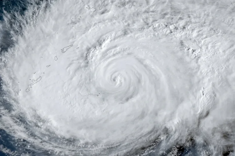
Nearly 260,000 people have been ordered to leave their homes in southern Japan and more than 500 flights have been cancelled as Typhoon Dolphin sweeps across the country's southern islands and brings heavy rain to a region still recovering from last week's deadly earthquake.
Dolphin passed close to Okinoerabu, one of a chain of small islands between Kyushu and Okinawa, on Friday morning, moving west at 25kmph with sustained winds near its centre of 144kmph, the Japan Meteorological Agency said. A gust of 148kmph was recorded on Tokunoshima, further north in the same chain, shortly before 7am.
The storm's outer edge is sweeping Kyushu, including Kumamoto prefecture, where about 6,700 people are still in evacuation centres after the magnitude 7.1 earthquake that killed 38 people on 28 July and brought down large numbers of houses. Residents there spent Thursday covering damaged roofs with plastic sheeting.
The evacuation orders cover Kagoshima and Okinawa prefectures, where forecasters warned gusts could reach 198kmph, strong enough to damage or destroy buildings.
Up to 200mm of rain is expected in the 24 hours to Saturday morning, and the weather agency has warned of the risk of a linear rain band, a narrow corridor of intense thunderstorms that can sit over one area for hours and trigger flooding and landslides. Forecasters have warned separately of heatstroke risk in southern Japan, with temperatures expected to reach 36C.
Toyota suspended production at nine factories in Japan on Friday over fears the storm would disrupt the shipping of finished vehicles.
Dolphin is forecast to cross the East China Sea over the weekend and come ashore between southern Zhejiang and northern Fujian provinces, on China's eastern coast, from Sunday afternoon to early Monday.
China's National Meteorological Centre has kept a yellow alert in force, the third of its four warning levels, and expects the storm to hold its strength or strengthen slightly before reaching the coast.
The centre put the storm 820km east of Wenzhou at 8am on Friday, with sustained winds of 162kmph. Its estimate is higher than Japan's because the two agencies measure wind speeds over different periods.
Zhejiang and Fujian both activated the lowest level of their four-stage typhoon emergency response on Thursday afternoon. All 193 offshore construction projects in Zhejiang have been halted, 474 construction vessels sent to safe anchorage and more than 10,000 people moved off outlying islands. Fujian expects between 100mm and 200mm of rain from Sunday to Wednesday, with up to 300mm in places.
Dong Lin, chief forecaster at China's National Meteorological Centre, said the storm was unusual in having formed west of the international date line and travelled so far before reaching China at this strength, according to China Daily.
Its path after landfall is uncertain, he said, because a split in the subtropical high-pressure system that would normally steer it has weakened that influence. The storm could linger over southern China for two or three days, or turn north and bring prolonged wind and rain to the north of the country.
Northern Taiwan was forecast to receive between 50mm and 80mm of rain from Friday afternoon.
Dolphin has already shaped the weather well beyond its track. Forecasters in South Korea, where a heatwave has killed at least 21 people, said the storm had strengthened the easterly winds crossing the peninsula's mountains, which warm as they descend the western side and have pushed temperatures in Seoul close to record levels this week.