NASA’s Curiosity rover has spent most of its nearly 15 year tenure on Mars trudging uphill. In 2014, the explorer began a slow ascent of Mount Sharp, a three-mile-tall formation in the middle of Gale crater. Although arid and frigid today, researchers believe that the mountain’s foothills hosted waterways billions of years ago. These streams likely emptied into a surrounding lake.
NASA mission specialists weren’t exactly surprised to spot the honeycomb-like patterns that can indicate long-gone water and mud crisscrossing the ground in a recent photo taken by Curiosity. They just didn’t expect to see quite so many of these patterns..
Curiosity snapped the 360-degree panorama image inside a valley called Valle Grande on June 19 and 20—the rover’s 4,930th and 4,931st days on Mars. The photo showcases geometric textures called polygonal fractures, each measuring 1.5 to three inches in diameter. Researchers previously documented similar polygons in the past formed by mud cracks, but there are multiple ways that could have created them billions of years ago. Geological compressions or even high temperature swings can squeeze moisture out of the sediment, leaving behind the distinctive arrangement.
“We’ve seen a lot of fascinating landscapes through Curiosity’s eyes, but this sea of polygons took our breath away,” Ashwin Vasavada, a NASA project scientist, said in a statement. “We measured their shapes and chemistry carefully and are hopeful there are clues in the data as to how these features formed.”
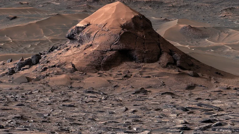
The polygonal fractures surround another impressive feature on Mars that Curiosity also photographed. On June 11, the rover used its Mast Camera to take an 11-picture portrait of a roughly 20-foot-tall, sand-topped butte nicknamed Miraflores.
Although Miraflores now tapers into a pointed top, the butte was once much wider before erosion carved it into the shape it is today—the same processes that created the valley Curiosity is currently exploring.