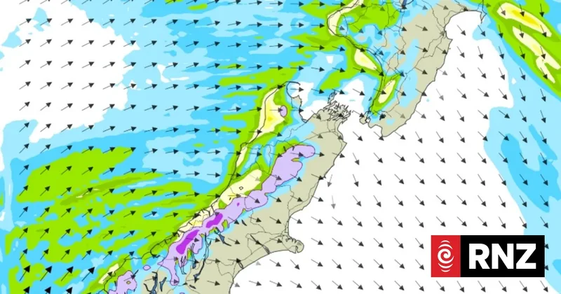
The country is set to face a chilly weekend as subantarctic winds move up the country, MetService says.
In the South Island, temperatures will start to drop in the south on Friday morning as the southerly pushes through Otago, and then into Canterbury this afternoon, with colder temperatures expected overnight Friday and Saturday.
MetService has road snowfall warnings in place for South Island mountain passes on Friday and the Desert Road on Saturday.
The mountain passes include Crown Range Road, Lindis Pass, Milford Road, Arthur's, Porters and Lewis Pass.
Meanwhile, the northern Cook Strait and the North Taranaki Bight have experienced thunderstorms.
Strong wind watches are also in place for parts of the South Island.
Coastal Otago's watch is in place from noon to 10pm on Friday, where southwest winds may approach severe gale in exposed places.
A watch for Christchurch, Banks Peninsula and the Canterbury Plains kicks off from 5pm Friday until 1am Saturday.
The watch for coastal Southland and southern Fiordland kicked in late Thursday and continues until 5pm Friday.
All watches have a moderate chance of being upgraded to a warning.
MetService said subantarctic air was being dragged north by southerly winds - resulting in "bitterly cold conditions".
It would make temperatures feel close to -2C in Invercargill on Friday afternoon "and even colder for higher elevations".
The cold weather would move up to the North Island during Saturday, it said, "with the wind chill cooling things to a feels-like temperature of just 1C in Wellington".
For those running or on the sidelines at the Taupō marathon, meteorologist Braydon While suggested dressing warm.
"Those preparing for the marathon, whether competing or cheering on the sidelines, will want to wrap up warm and bring a cosy jacket in case a few showers manage to sneak over the hills."
Sunday would bring clear skies for most of the country, MetService said, and "widespread frosts".
"Looking towards the start of the working week another cold front approaches the country, bringing some more showers for western and southern areas."