In March 2021, while serving as a senior fellow at the Brookings Institution, I hosted a discussion with General Chance Saltzman, now Chief of Space Operations for the United States Space Force. We examined how the 1991 Gulf War became, in many respects, the first “space war,” as capabilities such as the Global Positioning System (GPS) enabled precision-guided munitions and enhanced U.S. and allied military operations.
Reflecting on that conversation today raises a broader question: What have the wars in Ukraine and the Middle East taught us about the role of space in modern warfare? The central lesson is clear: Space has become even more consequential to the U.S., its allies and its adversaries. To operate effectively in this increasingly contested environment, the U.S. and its allies must strengthen coordination with the commercial space sector, protect their space systems and the data they provide and develop the means to deny adversaries the effective use of space.
Commercial space preserves Ukrainian communications
At the outset of Russia’s full-scale invasion of Ukraine in February 2022, many analysts expected Moscow to use coordinated cyberattacks and electronic warfare to destroy or severely degrade Ukraine’s communications and command-and-control networks. The objective was clear: to blind Ukrainian forces, disrupt their ability to coordinate military operations and prevent them from mounting an effective defense. Yet Russia failed to achieve that objective. A major reason was Starlink. The Ukrainian government and armed forces were able to preserve essential communications, coordinate military operations, and maintain command and control even as Russia attacked Ukraine’s conventional telecommunications networks. Ukraine’s early access to Starlink should therefore be regarded as one of the most consequential uses of commercial space capabilities in modern warfare.
GNSS remains central to modern warfare
Global Navigation Satellite Systems, or GNSS, are satellite constellations that provide positioning, navigation and timing services on a global or regional basis. Although satellite navigation was still relatively new during the 1991 Gulf War, the wars in Ukraine and the Middle East demonstrate how dramatically its military role has expanded. GNSS now supports far more than the navigation of aircraft and precision-guided munitions. It enables the operation of drones, the coordination of dispersed forces, the synchronization of communications networks and increasingly accurate strikes over long distances. Reliable access to positioning, navigation and timing has consequently become an essential requirement for modern military operations.
The 2026 conflict with Iran illustrates both the continuing importance and the proliferation of these capabilities. The U.S. and Israel have employed large numbers of precision-guided weapons against Iranian military, missile, naval and nuclear-related targets. U.S. Central Command reports that its operations have focused on degrading the Iranian military capabilities considered most threatening to U.S. forces and regional partners.
Unlike in 1991, however, the U.S. no longer holds anything approaching a monopoly on satellite-enabled precision. Iran has also used increasingly accurate missiles and drones to attack U.S. bases and other targets throughout the region. Some analysts believe Iran may be using China’s BeiDou satellite navigation system to improve the accuracy and resilience of these weapons, although Iran’s operational access to BeiDou’s protected military services has not been publicly confirmed. The significance of this development extends beyond Iran. Precision-strike capabilities that were once available only to a small number of technologically advanced militaries are increasingly accessible to a broader range of states. The proliferation of systems such as BeiDou allows potential adversaries to reduce their reliance on GPS and may make it more difficult for the U.S. to deny them access to satellite-navigation signals during a conflict. GNSS has therefore become not only an instrument of American and allied military power, but also an increasingly important enabler of adversary operations.
Yet the growing dependence on GNSS has also created new vulnerabilities. The wars in Ukraine and the Middle East have featured extensive efforts to jam or spoof satellite-navigation signals. Jamming overwhelms legitimate signals and prevents a receiver from determining its location, while spoofing transmits false information that causes the receiver to calculate an inaccurate position. These operations are intended to disrupt missiles and drones, protect military installations and critical infrastructure, and interfere with an adversary’s command-and-control and logistical networks.
The effects are not confined to the battlefield. During the conflict with Iran, GNSS interference spread across the Persian Gulf and the Gulf of Oman, affecting hundreds of commercial vessels and producing false or unreliable position data. Similar interference has become persistent in the Black Sea, where Russian efforts to disrupt Ukrainian operations have also created hazards for civilian aviation and maritime traffic.
The lesson is therefore not simply that GNSS remains relevant. Access to resilient positioning, navigation, and timing has become a prerequisite for modern warfare — and the signals and data supplied by these systems have become targets in their own right. The U.S. and its allies must be able to protect their access to GPS and other navigation services, operate effectively in jammed or spoofed environments, and deny adversaries the unrestricted use of their own space-enabled navigation capabilities.
The proliferation of commercial space imagery
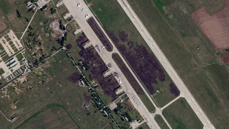
Another major development since the 1991 Gulf War has been the dramatic expansion in the quantity, quality and availability of commercial satellite imagery. Images that once could be collected only by a small number of highly classified government systems can now be purchased by governments, companies, journalists and private individuals around the world. This growing commercial capability offers the U.S. and its allies an important opportunity to supplement government-owned systems, expand battlefield awareness and provide military commanders with more frequent coverage of potential targets and areas of operation.
The same imagery, however, is also available to potential adversaries. Commercial satellite companies do not operate solely for the benefit of the U.S. and its allies, and the data they collect can reveal troop deployments, aircraft movements, naval operations, logistics hubs and activity at forward military bases. During the conflict with Iran, Planet reportedly notified customers that it was imposing a voluntary 14-day restriction on the distribution of certain imagery from the Persian Gulf region. The decision highlighted growing concerns that commercially available imagery could be used to monitor U.S. and allied military operations during an active conflict.
The episode also exposed the limits of government control over the commercial space sector. The U.S. currently has only limited authority to prevent American companies from distributing unclassified imagery of a combat theater. Even if Washington adopted more restrictive laws or regulations, those measures would not necessarily apply to commercial operators based in Europe, China or elsewhere. Nor would they prevent adversaries from purchasing imagery through intermediaries or obtaining similar information from foreign providers.
The strategic implication is clear: the U.S. and its allies can no longer assume that weaker states or non-state actors will lack access to sophisticated overhead surveillance. Even militaries without their own reconnaissance satellites may be able to acquire timely, high-resolution imagery of U.S. bases, deployed forces, ports, airfields, and logistical networks. In future conflicts, American commanders will therefore need to operate on the assumption that their activities may be observed from space.
This new reality places a premium on concealment, deception, dispersion, mobility and operational security. It also reinforces the need for closer coordination between governments and commercial imagery providers during crises. Commercial satellite imagery has become an indispensable source of intelligence for the U.S. and its allies, but it has also made the modern battlefield increasingly transparent. In an era of widely available space-based surveillance, there are fewer places — and fewer military activities — that can remain hidden for long.
Nuclear weapons in space
The resilience demonstrated by proliferated commercial constellations in Ukraine also creates a new counterspace challenge: adversaries may seek weapons capable of disabling entire constellations rather than attacking satellites individually
This challenge may be one factor behind Russia’s reported development of a space-based nuclear anti-satellite capability. According to the U.S. Director of National Intelligence’s 2026 Annual Threat Assessment, “Russia is developing a new satellite meant to carry a nuclear weapon as an antisatellite capability. A nuclear detonation in outer space would harm all countries’ national security and commercial satellites and infrastructure, as well as impair U.S. use of space as a driver for economic development.”
Unlike a conventional anti-satellite weapon directed against a specific target, a nuclear detonation in space could damage or disable large numbers of satellites belonging to the U.S., its allies, neutral countries and private companies. Its effects would therefore be indiscriminate, potentially disrupting military communications, missile warning, navigation, intelligence collection, financial transactions, transportation and other services upon which the global economy increasingly depends. Such a capability would threaten not merely individual satellites, but the broader space infrastructure that supports modern military and civilian life.
The U.S. and its allies must therefore make detecting, tracking and countering such systems a priority. They should also improve the resilience of their space architectures, strengthen coordination with commercial operators and develop credible diplomatic, economic and military responses capable of deterring the deployment or use of nuclear weapons in space. The proliferation of satellite constellations may make space capabilities more resilient to traditional attack, but it is also encouraging adversaries to consider methods of destruction whose consequences could extend far beyond the battlefield.
Recommendations for improving space system resilience
Given the lessons of the wars in Ukraine and the Middle East, as well as the broader changes transforming the space environment, what specific actions should the U.S. and its allies take? Five priorities stand out.
1. Increase the resilience of GPS. The U.S. military has access to M-Code, an encrypted GPS signal that is significantly more resistant to jamming and spoofing than civilian signals. This provides an important advantage, but adversaries will continue improving their electronic warfare capabilities. As the U.S. develops the next generation of GPS satellites and receivers, it must strengthen encryption, improve resistance to interference and ensure that military forces can continue operating when GPS signals are degraded or unavailable.
2. Pursue access to Galileo’s Public Regulated Service. The European Union is developing the Public Regulated Service, or PRS, as a secure and resilient component of the Galileo navigation system. U.S. access to PRS could provide an important alternative source of positioning, navigation and timing if an adversary successfully disrupted GPS. Washington should therefore negotiate appropriate arrangements with the European Union to provide greater redundancy for U.S. and allied military operations.
3. Be prepared to deny adversaries the use of space. Given the proliferation of space systems and their growing importance to military operations, the U.S. and its allies must possess capabilities that can deny adversaries access to hostile space services and space-derived data. One example is the Counter Communications System, which can disrupt adversary satellite communications. Future counterspace capabilities should, whenever possible, be reversible, targeted and designed to avoid creating long-lived orbital debris.
4. Develop systems to detect nuclear weapons in orbit. The reported development of a satellite capable of carrying a nuclear anti-satellite weapon makes improved detection an urgent priority. The U.S. government should work with the national laboratories, universities, and commercial industry to develop affordable systems capable of identifying and tracking potential nuclear payloads in orbit. Recent academic research suggests that such detection may be technically feasible without relying solely on highly classified systems.
5. Deepen cooperation with the commercial space sector. Commercial space companies have fundamentally changed the strategic importance of space. As I have noted elsewhere, the U.S. government must improve the integration of commercial communications, imagery and data services into military planning and operations. At the same time, it should work with industry and allied governments to reduce the risk that adversaries can use commercially available imagery and other space-derived information to monitor U.S. forces during a conflict.
The central lesson is clear: the U.S. and its allies can no longer assume that access to space will be assured or that its benefits will remain uniquely theirs. Maintaining a military advantage will require them to protect and diversify their own space capabilities, integrate commercial systems more effectively and be prepared to deny adversaries the unrestricted use of space and space-derived data. In modern warfare, control of the terrestrial battlefield will increasingly depend on the ability to operate — and prevail — in the space domain
Frank A. Rose is President of Chevalier Strategic Advisors, a strategic advisory firm focused on geopolitics and defense technology, and a member of the board of Divergent Space Technologies. He previously served as U.S. Assistant Secretary of State for Arms Control and as Deputy Assistant Secretary of State for Space and Defense Policy, where he worked on space security issues.
SpaceNews is committed to publishing our community’s diverse perspectives. Whether you’re an academic, executive, engineer or even just a concerned citizen of the cosmos, send your arguments and viewpoints to opinion (at) spacenews.com to be considered for publication online or in our next magazine. If you have something to submit, read some of our recent opinion articles and our submission guidelines to get a sense of what we’re looking for. The perspectives shared in these opinion articles are solely those of the authors and do not necessarily represent their employers or professional affiliations.