‘Maymay’ further weakens over Cordilleras
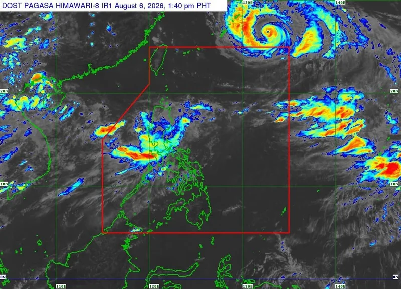
MANILA, Philippines — Tropical Depression Maymay (international name: Kujira) has further weakened while moving over the Cordilleras, the state weather bureau PAGASA said.
As of 2 p.m., the center of Maymay was last estimated in the vicinity of Gamu, Isabela.
Maymay now packs maximum sustained winds of 45 kilometers per hour (kph) near the center and gustiness of up to 75 kph, moving east-southeastward at 20 kph.
Despite the cyclone's downgrade, Signal No. 1 remains hoisted over vast portions of Northern and Central Luzon. Areas under Signal No. 1 can expect strong winds ranging from 39 to 61 kph within 36 hours, posing a minimal to minor threat to life and property:
- Ilocos Norte
- Ilocos Sur
- La Union
- Northwestern portion of Pangasinan (Bolinao, Anda, Bani)
- Apayao
- Abra
- Kalinga
- Mountain Province
- Ifugao
- Benguet
- Mainland Cagayan
- Isabela
- Quirino
- Nueva Vizcaya
- Northern and central portions of Aurora (Dilasag, Casiguran, Dinalungan, Dipaculao)
PAGASA noted that the combined peripheral effect of Maymay and the enhanced Southwest Monsoon, locally known as habagat, will continue to bring strong to gale-force gusts across most parts of the country through Saturday, August 8.
The state weather bureau forecasts Maymay to traverse the mountainous terrain of Northern Luzon before emerging over the eastern coastal waters of Isabela within the next 12 hours.
PAGASA expects Maymay to downgrade into a remnant low by Thursday afternoon or evening, which will then move southeastward until it eventually merges into the circulation of Tropical Cyclone Dolphin.
- Latest
- Trending