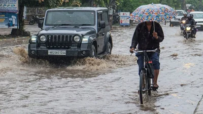
India will wake up on Wednesday, July 22, to two very different monsoons. The India Meteorological Department (IMD) has warned of heavy to very heavy rain at a few places, with extremely heavy rain at isolated places, over the Gujarat Region and Madhya Maharashtra.
The weather department says rainfall over South Peninsular India will stay subdued for the next seven days.
WHAT DOES EXTREMELY HEAVY RAINFALL MEAN?
These are not vague words. IMD uses fixed numbers. Heavy rain means 64.5 to 115.5 mm in 24 hours. Very heavy means 115.6 to 204.4 mm.
Extremely heavy means more than 204.4 mm, which is over 20 cm of water in a single day. Pardi in Valsad district recorded 21 cm in the 24 hours ending 8:30 am IST on July 21.
WHICH STATES WILL GET HEAVY RAIN ON WEDNESDAY?
Isolated very heavy rain is likely over Himachal Pradesh, the Jammu-Kashmir-Ladakh belt, Punjab, East Rajasthan, East and West Madhya Pradesh, and Konkan and Goa.
Isolated heavy rain is forecast over Uttarakhand, Haryana, Chandigarh and Delhi, both halves of Uttar Pradesh, Vidarbha, Chhattisgarh, Bihar and Odisha. Assam, Meghalaya and the Nagaland-Manipur-Mizoram-Tripura belt stay wet too.
WHY IS SOUTH INDIA STAYING DRY?
Because the monsoon has moved its furniture north. Only isolated to scattered rain is forecast over Coastal Andhra Pradesh, Rayalaseema, Tamil Nadu, Telangana and interior Karnataka through July 27.
Coastal Karnataka and Kerala are the exception, since the Western Ghats squeeze rain out of moist sea winds regardless. Elsewhere in the peninsula, the main story is gusty wind, not water.
WHAT IS THE DELHI WEATHER FORECAST FOR TOMORROW?
Generally cloudy. One or two spells of very light to light rain at many places, with moderate rain at a few places, from early morning to noon, along with thunderstorm, lightning and winds of 20 to 30 kmph gusting to 40 kmph.
A second spell is likely between evening and night. Maximum temperature 31 to 33 degrees Celsius, minimum 24 to 26, both below normal.
WHERE IS THE FLASH FLOOD RISK HIGHEST?
The flash flood guidance, valid till the early hours of July 22, places low to moderate risk over watersheds in Jammu and Kashmir and Ladakh, in Himachal districts including Chamba, Kangra, Kullu, Shimla and Kinnaur, and in Uttarakhand districts including Dehradun, Uttarkashi, Chamoli and Pithoragarh.
Where soil is already soaked, fresh rain cannot sink in and runs straight off the slope. District warnings are updated here.
WHY IS THE MONSOON SO LOPSIDED?
The monsoon trough, the long belt of low pressure that steers monsoon rain across the country, is near its normal position.
Feeding it are five upper air cyclonic circulations, spinning columns of air a few kilometres above the ground that draw in moisture and force it upward. They sit over Haryana, northeast Madhya Pradesh, southwest Rajasthan, north Chhattisgarh and the Westcentral Bay of Bengal.
A trough links the Bay circulation to the northeast Arabian Sea, tying both seas into one rain machine over the north and west, and leaving the south out of it.
This wet-here, dry-there rhythm has a name. Scientists call them active and break phases, mapped in detail by Rajeevan, Gadgil and Bhate in the Journal of Earth System Science, and explained physically in Sulochana Gadgil's review in the Annual Review of Earth and Planetary Sciences.
The gap between the two extremes is also widening. Goswami and colleagues, writing in Science, found extreme rain events over central India rising while moderate rain declines.
A later study led by Roxy Mathew Koll in Nature Communications reported a threefold rise in widespread extreme rain events over central India between 1950 and 2015, linked to a warming Arabian Sea. The same monsoon, delivered in fewer and fiercer bursts.
Fishermen have been advised to avoid waters off Gujarat and north Maharashtra until July 24, and off the Andhra Pradesh coast until July 22.
- Ends
Published By:
Radifah Kabir
Published On:
Jul 21, 2026 19:30 IST