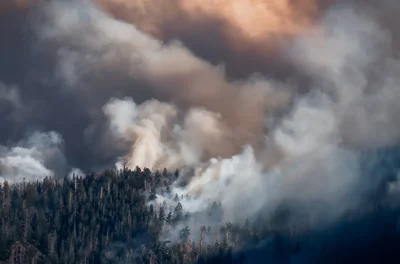
At the end of the particularly hot and dry summer of 1910, a series of lightning storms and human-caused sparks set 1,736 small fires across the northwestern U.S. Hurricane-force winds fanned the flames, merging the fires into a three-million-acre inferno that destroyed several towns and claimed nearly 90 lives. Those working to staunch the blaze saw walls of fire hundreds of feet high, with one forester comparing them to a “veritable red demon from hell.”
Known as the “Big Blowup” or the “Big Burn,” the 1910 conflagration is still the largest forest fire in U.S. history, but climate change and the expansion of people into once-wild areas are increasing the risk of damaging blazes. Each year, wildfires in the U.S directly kill about two dozen people on average, cause countless smoke-related illnesses and cost hundreds of billions of dollars. In the past decade alone, wildfires have destroyed more than 97,000 structures. The increasing scale of the wildfire problem has made them more difficult to fight, with firefighting personnel and equipment shared between states or countries stretched thin as global fire seasons start to overlap and increase in intensity.
On supporting science journalism
If you're enjoying this article, consider supporting our award-winning journalism by subscribing. By purchasing a subscription you are helping to ensure the future of impactful stories about the discoveries and ideas shaping our world today.
The best way to prevent this destruction is also one of the most difficult: detect fires before they spiral out of control. In the century after the Big Burn, little in wildfire detection changed, but now fire experts say technology is allowing the field to finally make real progress.
“All of these technologies are coming together, and they’re positioning us in a better place,” says Neal Driscoll, principal investigator of ALERTCalifornia, a public safety and wildfire monitoring program based at the University of California, San Diego.
Ramping up Response
The slow evolution of these technologies started with the Big Burn itself. The U.S. Forest Service, then still in its infancy, used an influx of funds after the disaster to build a large network of seasonally staffed fire towers on top of mountains, high platforms and trees in fire-prone areas.
These towers—from which lookouts can see many miles into the distance in ideal conditions—were built all across the country. Across the tens of millions of acres of dry forests in the American West and brush-filled woods of the East, fire-prone land is nearly everywhere in the continental U.S.
By 1930 there were more than 8,000 of these structures across the country, each stocked with rudimentary technologies—primarily Osborne Fire Finders, which were surveying devices called alidades used to pinpoint the precise location of fires at a distance and direct fire crews. The Osborne Fire Finder, which doesn’t need electricity, is still used in some places to supplement modern GPS-linked locators.
Even today, lookout operators live with no running water and little electricity and spend their days watching the horizon and looking for anything out of place—a faint haze or fallen tree. “Your whole life is built around looking out of those windows,” says Michael Guerin, chairman of the Forest Fire Lookout Association and longtime volunteer lookout operator. “Your head’s always on a swivel, and you are always paying attention to your surroundings.... When you see your first smoke, your heart starts to race.”
Staffing and maintaining the lookout towers can be expensive, though, and many have been demolished in recent decades. Only a few hundred are still staffed. Even where towers are still in place and are still the best bet for spotting the first flickering of flames, sometimes there are not enough of them to keep watch over all parts of a fire-prone area.
But they’re still in use, in part because researchers haven’t been able to come up with technology that can yet provide comprehensive wildfire monitoring on its own.
Spotting Fires from Space
Satellites have been used to spot fires since 1980, when the NOAA-6 weather satellite identified a series of bright spots in an image of the Persian Gulf that turned out to be methane burning above oil wells. This discovery led to dedicated environmental observation instruments in space that have helped fire researchers get a better understanding of global wildfire activity and the extent of recent and active fires.
But there are technological limits to current satellites’ fire detection abilities. Geostationary satellites, which steadily gaze upon one region on Earth from a comparatively high orbit, can provide more frequent updates but are too far away to image the small, early-stage burning that firefighters have the best chance of stopping quickly. Satellites in low-Earth orbit can see these smaller fires but can only pass by a given area three to four times daily—much too slow to catch fast-moving flames.
The technology infrastructure nonprofit Earth Fire Alliance is trying to solve this problem with the relatively new idea of a multisatellite constellation. The 50-plus satellites it has planned would be close enough together that they could take frequent photos and generate data on even very fast-moving conflagrations and close enough to Earth to photograph even very small fires. Its single-satellite prototype launched in March of last year, three of the fully functional satellites launched earlier this month, and the rest of the array is expected to launch within the next four years. Data from these satellites will then be integrated with the monitoring systems of several national and state-level fire services around the world—some of which are already using the prototype’s data to prepare for this integration.
“One of the first fires we detected was a small roadside fire in Oregon,” says lead scientist Michael Falkowski, a former program manager in NASA’s Earth Science Division. “It was started by somebody that was dragging trailer chains behind their vehicle on the highway, and it sparked two or three really tiny fires. They never got to be more than a half-acre in size, and we were able to see them from space.”
Eyes on the Ground
In addition to trying to spot fires from above, camera systems and sensors have been put in place in some places—notably in California—to watch more locations more continuously than humans in towers can. Though these systems are prone to missing fires when the smoke is blowing away from the sensors, they remain one of the main sources of information for firefighters and communities at risk from wildfires.
ALERTCalifornia manages a network of more than 1,200 cameras monitored by firefighters and researchers around the state. They can watch as fires move and expand, allocating resources to the fires that need them most and finding the safest route for firefighters to reach the flames.
“Often we beat the 911 call,” Driscoll, the project’s principal investigator, says. “The success of this program is measured by the fires you never hear about because they were suppressed before a 911 call or they never grew large enough to have a name.”
The program maintains the third generation of wildfire monitoring systems at the University of California, San Diego. Between 2019 and 2023 it doubled the number of sensors watching over the Californian countryside, and since 2023 it has focused its efforts on integrating AI into the system to keep watch when humans can’t.
Kern County, Calif., deputy fire chief Zachary Wells says that earlier this fire season, he was able to use a combination of new data sources to plan a response for two nearby fires that started just minutes apart. They might have been mistaken for the same blaze if the only information available had been from 911 calls.
“I was able to see and get a notification through AI that another fire had started, and I could say with 100 percent confidence this is a new fire,” Wells recalls. “Our chief officers were able to divert equipment and ensure that we could get firefighters to this new start, so that both responses were getting adequate equipment.”
In some other Western states, including Oregon, Nevada and Arizona, similar camera systems exist. Installing and maintaining them can get expensive, however, and some fire-prone areas are too thickly vegetated or rainy to benefit from their surveillance. Still, that these high-tech systems exist at all provides a level of ease unimaginable to the emergency responders fighting the Big Burn more than a century ago. And these systems could help reduce the odds that the 2026 fire season—already off to a roaring start across the country—will produce another Big Burn.
“Using technology to enhance our ability to make decisions [about wildfire response] has really benefited us,” Wells says. “We only see that growing and evolving over time.”